THE SITE AND ITS CONTEXT

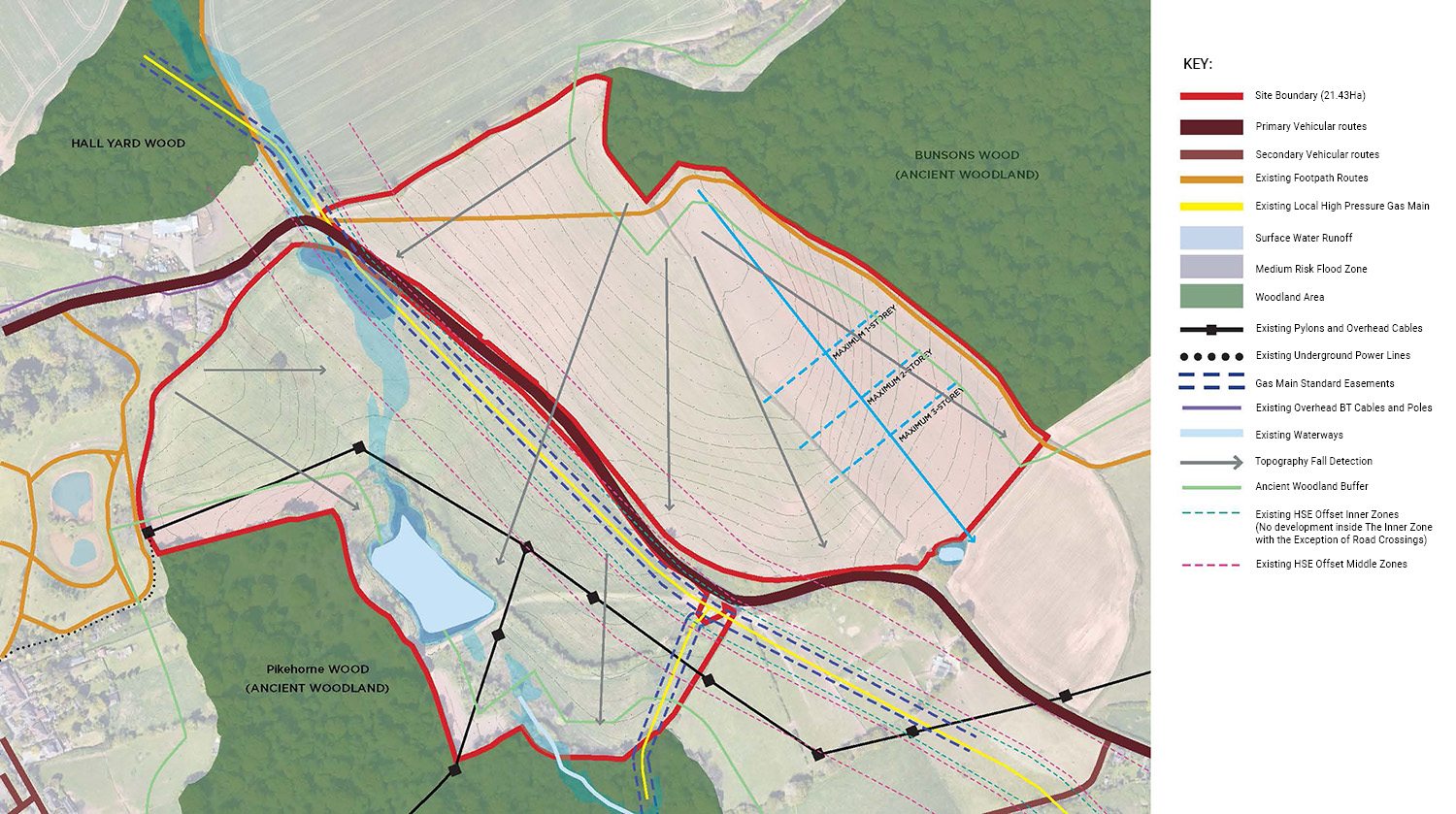
The Site is located to the west of Keresley and north-west of Coventry. The site comprises two land parcels separated by Fivefield Road, spanning 21.43 hectares. The site is located within the Keresley Sustainable Urban Extension (SUE) under the Coventry Local Plan (2011-2031), which supports residential development to meet Coventry’s housing needs.

The masterplans have been informed by an appraisal of the opportunities and constraints as shown on the plans on this page. There are opportunities for:

  • New areas of enhanced public open space.
  • The land is suitable for a sustainable drainage system, to manage surface water run-off from the site.
  • New cycle and pedestrian accesses joining into the wider network within the Keresley SUE.

There are few constraints to development:

  • Ancient woodlands exist to the north (Bunsons Wood) and to the south (Pikehorne Wood). A wide landscape buffer will be provided between the woodlands and built development to avoid any harm.
  • A gas easement corridor runs within the site and will be retained. A green corridor will be provided within this easement area.
  • A public right of way run across the northern edge of the site, there is potential to divert this to wrap closer to the site boundary.
  • There is a small risk of surface water flooding, with only limited areas of the site at risk of flooding. Built development will avoid these areas.
  • Trees of value will be retained.

CONSTRAINTS PLAN


YOUR VIEWS